More projects in this category
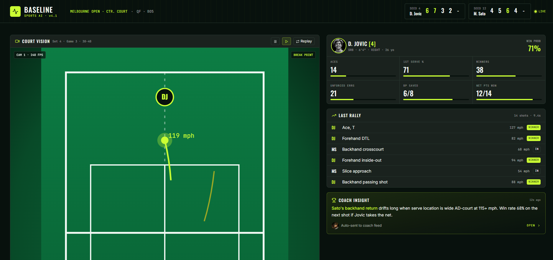
Tennis Performance AI
Coaches and players get broadcast-grade match analytics from a phone-recorded video — without a broadcast crew, without enterprise pricing, and without manual tagging.
View Project
Medical Diagnosis Support
Read times decreased 40%. Critical findings flagged within minutes instead of hours.
View Project
Physics Simulation Assistant
Simulation iteration cycles reduced from weeks to hours. Two new papers published in first quarter.
View Project